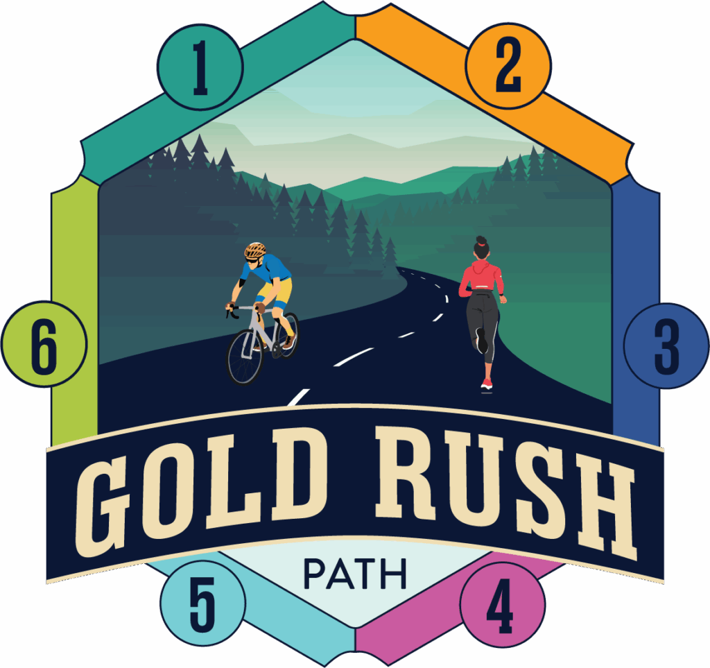
Project Overview
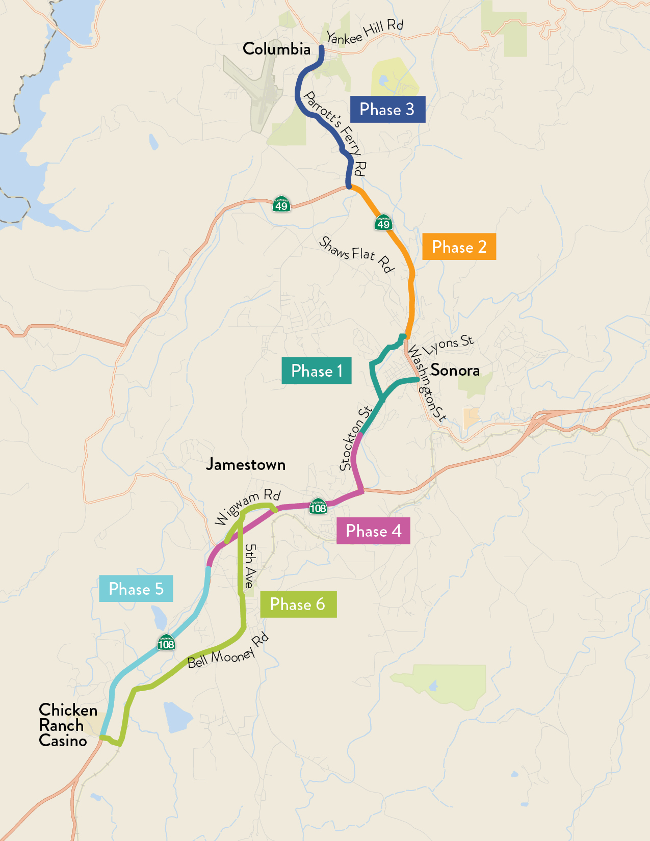
The completed Gold Rush Path will be a Class I facility that stretches over 14 miles to continuously connect the historic Tuolumne County communities of Jamestown, Sonora, and Columbia as well as the Chicken Ranch Tribal Lands. The path will improve active transportation continuity, encourage healthy and low emission travel behaviors, increase safety, maximize disadvantaged individuals’ access to critical services, and enhance community identity.
In 2025, a partnership led by the Tuolumne County Transportation Council (TCTC) will engage local communities along Phases 2 and 3 of the Gold Rush Path, stretching from Sonora High School to Columbia State Historic Park along SR-49 and Parrotts Ferry Road, to identify a preferred alignment. We welcome you to contact TCTC staff with questions about the project and participate in upcoming engagement events that will be posted to the project webpage below.
Phase II and III Project Map
Frequently Asked Questions
What are Complete Streets?
“Complete Streets” means designing roads so they are safe and comfortable for everyone—not just people driving. A Complete Street makes room for people walking, biking, using wheelchairs, pushing strollers, riding the bus, or driving.
What is a Class 1 Bike Lane? Who determines what the design can or can not include?
- A Class 1 bike path or shared-use path—is a trail that is completely separated from car traffic. It is not on the road. People walking, biking, using wheelchairs, pushing strollers, or skating can all use it. It’s the safest type of path because it keeps people away from moving cars.
- The rules for Class 1 facilities come mainly from Caltrans. Caltrans sets the standards for things like how wide the path must be, how it should be paved, how it connects to streets, what kinds of signs are needed, and how it should be designed for safety.
- Local agencies—like the County, the City, or TCTC—can share ideas and help shape the design, but the final design has to follow Caltrans guidelines. That ensures the path is safe, meets state requirements, and can qualify for state and federal funding.
Why are you spending money on this instead of fixing the roads?
- Most of the funding for this project comes from state and federal sources that cannot be used for road maintenance.
- These funds are specifically designated for active transportation, safety, and multimodal projects. If we don’t use them for this path, they simply go to other regions.
- Using outside funding for the path actually helps free up local dollars for road repair.
Does this project take money away from filling potholes?
- Road repair funding comes from completely different programs than trail and safety projects.
- Projects like this spur economic activity, attract residents and visitors, and support local businesses. That activity increases sales tax and tourism revenue, which ultimately creates more local funding for road repair and maintenance.
Where is the money coming from?
- The project is supported by state and federal grants dedicated to safety, active transportation, and multimodal mobility.
- These include programs like ATP (Active Transportation Program), federal safety grants, Caltrans-led project development, and Tribal-led funding for later phases.
- Local tax dollars are only a very small portion—and in some phases, zero.
Why invest in a path this long?
- A continuous path creates real value: safer routes to schools, downtowns, parks, neighborhoods, and transit.
- Short, disconnected segments don’t serve the community as well—connectivity is what makes active transportation useful and safe.
- It also promotes tourism and economic development, helping small businesses and historic downtowns.
Why build a path when our roads need so much work?
This project improves safety for walkers, cyclists, children, older adults, and people who don’t drive.
Why is it going to take so long to build the Path?
- Planning of each phase includes environmental and cultural resource studies as well as right-of-way determinations, and in some cases, acquisition of land.
- Much of the Path will be along the State Highway, constructed by Caltrans, which is a lengthy process.
- Getting funding secured can also take a long time.
- Phase 1 is already moving toward construction.
- Phases 2–6 are in development with multiple agencies involved.
- Each phase has its own funding pathway, so progress continues even while future phases are planned.
I never see anyone walking or biking—why build this?
- People walk and bike where it is safe to do so. In areas with dangerous or narrow shoulders, use stays low.
- When regions build protected, connected paths, use increases dramatically—by seniors, families, schoolchildren, and commuters.
- Safety infrastructure doesn’t just serve existing users; it creates new opportunities.
Will the Path attract new homeless encampments or criminal behavior?
- Across the country, well-designed shared-use paths generally do not lead to more encampments or more crime. In fact, research shows the opposite: when a path is well-used, well-lit, and actively maintained, it tends to make an area safer because more people are out walking and biking.
- If issues ever come up, we will work closely with local law enforcement, service providers, and nearby property owners to address them.
What about e-bikes and e-scooters? Will they be allowed on the Path? How will safety be addressed?
- Yes, most e-bikes will be allowed on the Path. In California, Class 1 and Class 2 e-bikes (the kinds that go up to 20 mph) are allowed on shared-use paths unless a local agency decides otherwise. Class 3 e-bikes (the faster ones that go up to 28 mph) are not allowed on paths like this.
- Electric scooters follow similar rules. They can use the Path as long as they are operated safely and follow posted speed limits.
- To keep everyone safe, the Path will have clear signs, posted speeds, and design features—like good visibility, gentle curves, and separate space from cars—that help all users share the space responsibly. Safety also comes from how the community uses the path: when more people walk and bike on a well-designed trail, riders tend to slow down and behave more predictably.
How come I’m only hearing about this now?
- I’m really glad you’re here today. We are still very early in the process, and this is the beginning of community engagement. You’re not late at all—this is exactly the stage when we want people to learn about the project, ask questions, and share their thoughts. There will be many more chances to get involved as the project moves forward.
- We also worked hard to get the word out widely. The event and project information have been shared through multiple channels for several weeks—online, in newsletters, in public meetings, and through partner organizations. Even with broad outreach, people hear about things at different times, so we’re glad the information reached you and that you came.
- If you’d like, we can help you find the best ways to stay connected—email updates, our website, or future meetings. We want the whole community to stay informed and involved as the project continues.
How can people share ideas?
- Feedback can be shared at our community engagement events or by contacting TCTC directly.
- We welcome all perspectives and want the community to help shape the project’s identity.
Why is the project currently called the Gold Rush Path?
“Gold Rush Path” has been used informally in planning documents for several years, but it was never selected through a formal naming or community engagement process.
What would be considered for a new project name?
- The name could draw from locally significant place names, natural features, or cultural landmarks unique to Tuolumne County.
- We want a name that is inclusive, place-based, and reflective of the region’s identity.
Our position on renaming
- TCTC and our project partners are open to renaming the project.
- No decisions have been made. This is the beginning of a collaborative process.
- We are actively inviting ideas and input from Tribal governments, community partners, and the public.